
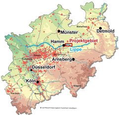
The project area - The Lippe Floodplain between Hangfort and Hamm
The Lippe is the northernmost tributary of the eastern part of the Rhine while running its course on the southern edge of the Westphalian Bight. Between the predominantly agriculturally used Münsterland in the north and the more industrially used conurbation of the Ruhr in the southwest, it represents an important “trail” for many organisms between Lower Rhine in the west and Weser in the east. Therefore, it plays a significant role as a linking element of biotopes.
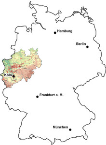
general map of germany and North Rhine-Westphalia: © based on Landesvermessungsamt North Rhine-Westphalia
The project area extends along the Lippe within the borders of the municipality of Hamm and the districts of Warendorf and Soest. It spans the whole FFH area „Lippe floodplain between Hangfort and Hamm“, with an extension of about 615 ha. Furthermore, it represents part of the bird protection area named „Lippe floodplain between Hamm and Lippstadt with Ahse meadows“, due to its special importance to bird species Europe-wide worth protecting. Stretching over an area of 2305 ha, the project area definitely outreaches the FFH area.

general map of action blocks: © Stadt Hamm, Umweltamt
In the project area four parts were chosen to realize renaturation measures in the so called action blocks. For further information on the exact position and the actions planned, please also see Measures of LIFE+.